Cuyahoga River Info
Upper Cuyahoga near Hiram also has a gauge at Hiram Rapids for the flatwater section above Camp Hi
Return to Portage Gauge
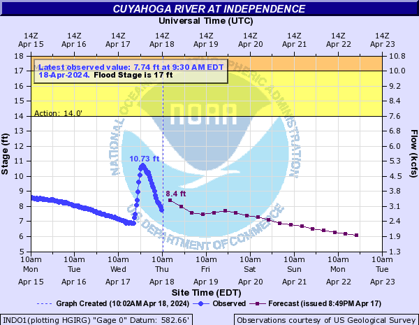
Lower Cuyahoga The National Park has a gauge at Jaite for Peninsula to Vaughn Rd or beyond.
AWA Lower Desciption
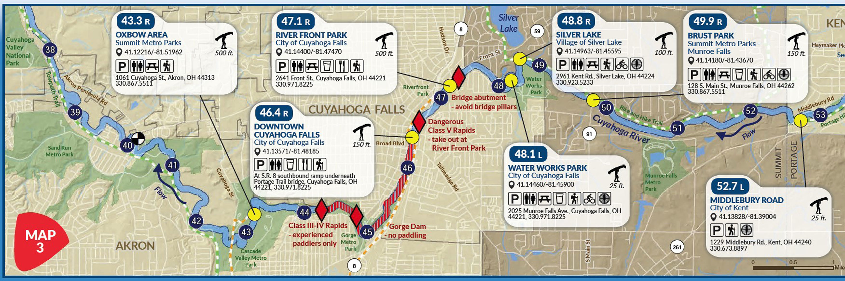
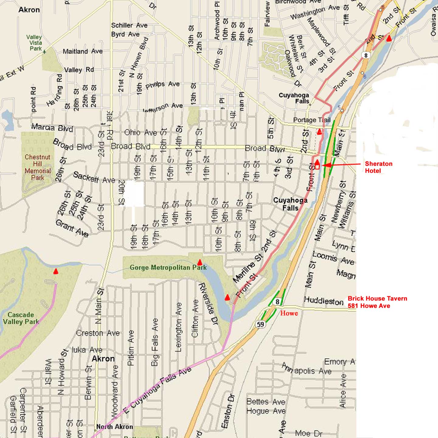
Cuyahoga at Sheraton Hotel(O to P) is probably at a runnable level between 250 cfs and 900 cfs
AWA Sheraton Desciption
Keel Hauler Rating 29
Detailed Gorge/Sheraton map
Cuyahoga Gorge(P to Q) is paddleable from 500 to 2000 cfs.
Keel Hauler Rating 16 to 20
AWA Gorge Desciption
Please be aware that a permit is required to put-in below the dam.
Get permit from this link, fill out on-line, save, print and mail in before attempting to run the section.
Updated Permit Application
How to fill out above Application
Summit Metro park - Gorge & Highbridge
ODNR Coastal Management Cuyahoga & Local River Information
Tinkers Creek a tributary of the Cuyahoga (See map above) is a steep whitewater stream with a large waterfall.
Keel Hauler Rating 30