Rocky River Info
Rocky River River USGS Gauge (04201500)Keel Hauler Difficulty Rating 17
Painted gauge on right side of Sprague bridge.
Low = 1.75'
Good = 2.5'
High = 4'
ODNR Access Map - Rocky River (OH)
AW River Info
Upper West Branch RR AW page
North Branch RR AW page
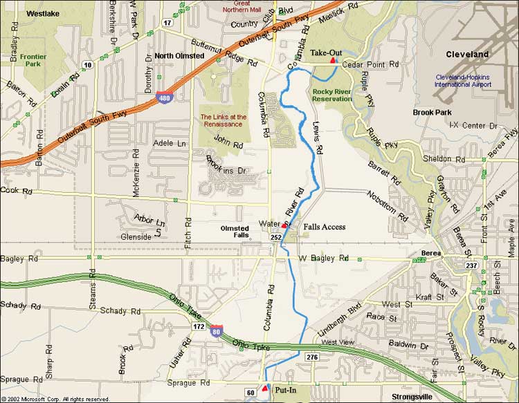
River Description - Flat water until old bridge Pier 500' before Bagley Rd.
Just after Bagley a wide surfable hydraulic on left
Long pool above first Low Head dam, very dangerous at high water
Can be run on left up to 3' (Sprague Gauge)
Class III rapid just below RR bridge followed by another low head dam.
Dam not runnable but slide on left side is.
Below Water street the river has nice gradient and surf waves all the way to take-out on the left just after Cedar Point Rd bridge.
PADDLERS MUST CALL OLMSTED FALLS FIRE DEPARTMENT AT 440-235-3238 BEFORE PADDLING, tell them number of paddlers and launch time