Return to previous page
Mexico 2014-15 Trip Map 8A
2014-15 Trip Plan
Read my Mexico Blog on Blogspot (2009 to 2015)
Our 2014-15 Mexico Trip Blog in Chronological Order


After Xpu-Ha our plan is to drive back to the USA border which usually takes 3-4 days. Others are recommending the center route through Laredo instead. We must decide on whether to take the fast Eastern route home or the mountain route to Puebla which is 100 extra miles of driving and $100 more dollars in tolls.
With Plan A we spend
1 night near Villahermosa
1 night near Cerro Azul
1 day north through Tampico to Los Indios, camp at Harlingen Wal-Mart

Last year we went with plan A 2014 Blog - Plan A


For center route through Laredo, See Center Trip Plan B for maps & time/mileage charts.
With Plan B
1 night near Villahermosa
1 night near San Juan del Rio after Arco Norte Bypass
1 night near Laredo using Cuota route through Satillo to Laredo

Cross the border, stop in TX


Previous Day Map - Go to Mexico Trip Map 7
Xpu-Ha to Villahermosa - Day 1
Mexico Trip Map 14_1
City City Miles Hours
Xpu-Ha Bacalar 150 3:30
Bacalar Escarcega 175 3:45
Escarcega MX186-MX199 120 2:45
MX186-MX199 Villahermosa 80 1:40
Totals Day 1 525 11:40

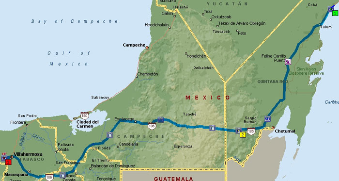
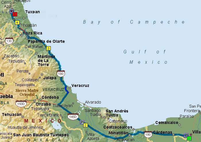
Villahermosa to Cerro Azul - Day 2
Mexico Trip Map 14_2a
City City Miles Hours
Villahermosa Acayucan 140 2:50
Acayucan S of Veracruz 145 3:00
S of Veracruz Emerald Coast 100 3:00
Emerald Coast Cerro Azul 100 2:45
Totals Day 2 485 11:20
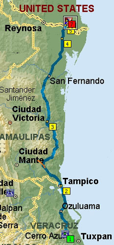
Cerro Azul to Los Indios - Day 3
Mexico Trip Map 14_3a
City City Miles Hours
Cerro Azul S Tampico 90 2:00
S Tampico Altamira 45 1:15
Altamira MX83/81 Xicotencati turn 57 1:05
Xicotencati turn on MX-81 To Ciudad Victoria-MX101/83 Interchange 60 1:10
MX101/83 Interchange MX180/101 Intersection 75 1:30
MX180/101 Intersection Los Indios 120 2:15
Los Indios Harlingen 15 0:45
       
Cerro Azul Harlingen 462 10:00

  • Read all of our Mexico stories
  • E-Mail to John Kobak