
Mexico Trip 2005
By John Kobak
Click here to send me an E-Mail to keelhauler@yahoo.com, Love to hear from you
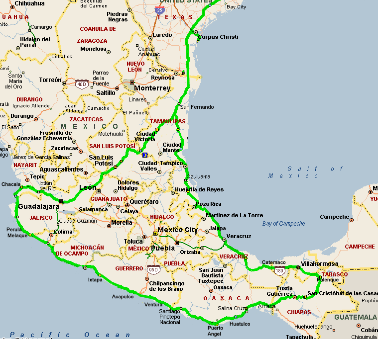
Map showing 2005 Trip
So far things have been going like clockwork. We had a warm spell in Cleveland with no freezing weather for the week before we left. We were able to get the RV ready and even fill the water tanks before we left. We watched all the weather reports and decided to leave on Sunday 1/2/05.
We left at 5:30 AM and had a few drizzles but generally good weather all the way to Jackson, TN. The temps were in high 60's when we overnighted at Wal-Mart. The next day the temps warmed to 78o and we pulled into Rich Priem's in Houston about 7PM.
After a week of buying & installing a really nice surround sound system for Rich and a few bike rides we were ready to set off on our journey to Mexico. We left on Monday morning 1/10/05.
It's about a 7-hour drive to the border town of Progreso. We chose this crossing since it is very small and you don't have to fight your way out of a large Mexican city like Matamoras. The border is open 24 hours a day so we figured we would camp in the large state side parking lot, where people park to walk across into Mexico to shop, and cross in the morning. It was a good thing I walked across to talk to the Mexican customs office. I found out that customs is only open from 9 AM to 6 PM. With some prodding they agreed to fill out our visas and vehicle permit, so that we were all set and could cross the border in the morning at 6:30 AM.
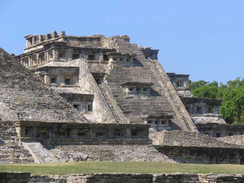
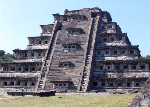
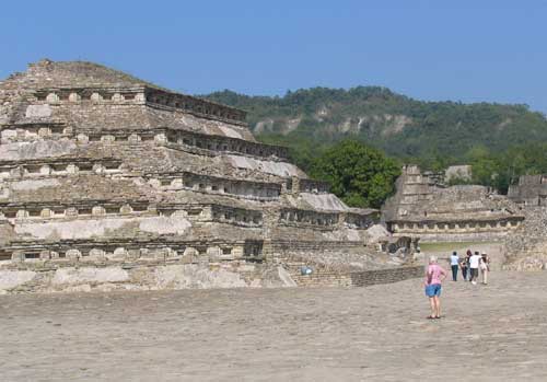
They just waved at us when we crossed the border. The traffic was very light heading south. We had planned to camp in Tampico but the place we had camped at in the past was closed and it was only 1pm, so we headed further south to a little town called Cerro Azul which had a small hotel with a nice grassy place to camp. In the morning we decided to wash the grime from the RV, it was greasy black from road oil and who knows what. It is only three hours from here to where we planned to spend a few days on what they call the Emerald Coast, so we decided to take a side trip to El Tajin on the way.
|
|
|
|
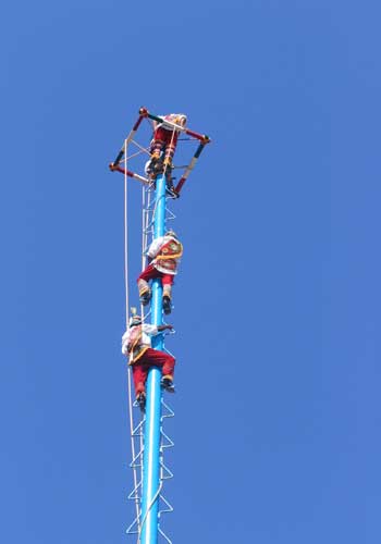
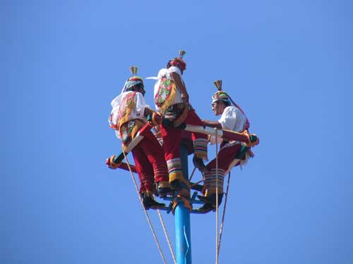
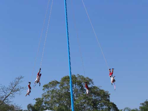
El Tajin is archeological site with pyramids and ball courts like the Mayan ruins but the people were called Totonac Indians. They put on a spectacle show that involves four Voladores descending from a very tall pole while whirling around tied to long ropes.
 |
 |
 |
 |
The Emerald Coast is about 100 miles north of Vera Cruz. We have stopped here on other trips but it was always cold and windy. It was sunny and 83o. However on Thursday morning while we were taking a walk on the 5-mile long beach a Norther hit with its 30-40 mph winds. Sand blowing down the beach into our faces on the return made it very unpleasant. It cooled to 74o and a few drops of rain fell, but the weather cleared to bright blue skies but the wind remained.
We decided the weather was too cool to stay at the beach so on Friday we headed
south. bypassing the city of Vera Cruz. The roads got bad until we got south of Vera Cruz. We headed up to
a mountain lake called Catemaco. It was the weekend and lots of Spanish tourists were taking launches across the lake to see the wildlife. We stayed in a crappy little campground next to a restaurant right in town, convenient but noisy.
The next morning we decided to move to a resort spa a few miles out of town right on the water. Practically no one was
here and the place was gorgeous. But after a short hike around their grounds the rain started to fall. It rained on and off all day limiting what we could do. If it would have cleared up on Monday we would have stayed. But no luck, the rain continued so we headed south to Villahermosa.
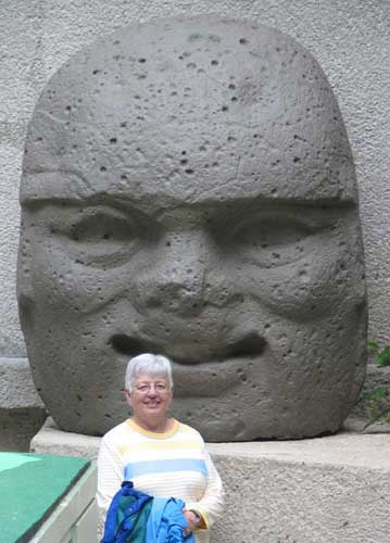
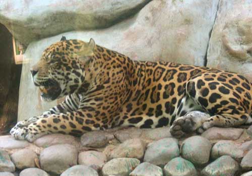
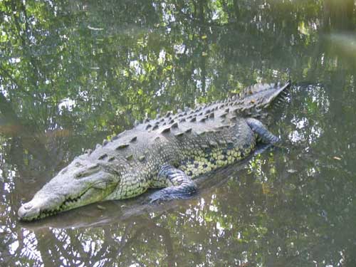
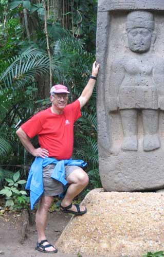
It was big town, which had a nice museum/zoo called La Venta. It had huge
stone objects of art from the Olmec Indians, who predated the Mayas. Actually,
all of the stuff was moved from the original archeological site, since they
discovered oil there and the art was in the way.
|
|
 |
 |
 |
Even though we got stuck in a traffic tie up for an hour while a small van burned up,
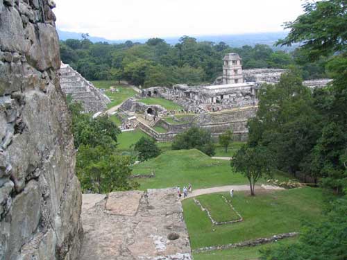
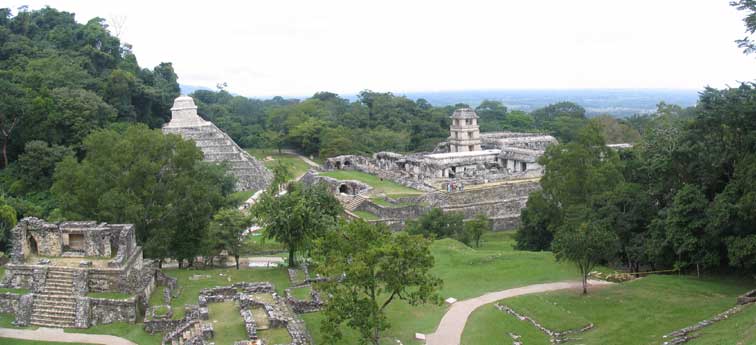
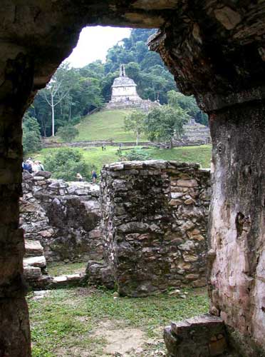
we were done by 3 PM. Instead of camping near the city, we headed into Chiapas to the big Mayan ruins of Palenque.
Palenque was much more touristy then El Tajin and the total size of of the area
was 4 times as large. However most of it was off limits and you were confined to
a small number of ruins. You could climb anywhere you wanted on them whereas at
El Tajin you could not. They had a big museum but it was under renovation and
closed.
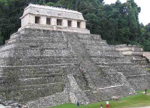
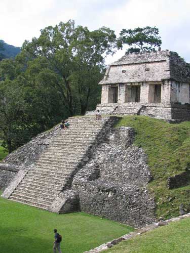
The Maya Bell campground was very convenient to the ruins. You camped right on
the edge. We toured the ruins in the morning but they are much smaller then I had thought so
that we were done by noon. We took a taxi to town and spent the afternoon shopping. No rain here and temps were in the mid 70's.
|
|
|
|
 |
 |
Click this link to go to next page - Mexico 2005 - Page 2
Mexico 2004 Report
- West Coast
Mexico 2000 Report
- Kayak Trip